The Iranian Silk Road
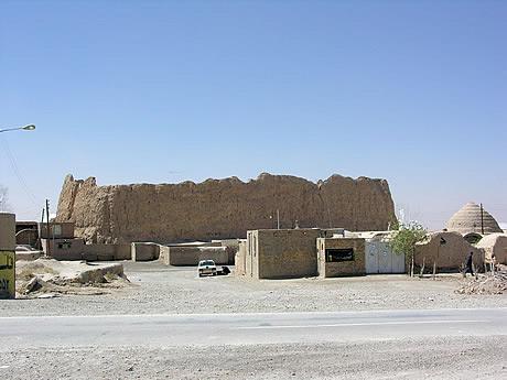
Here are the remains of the ancient qaleh (fort) in Deh Namak. This has ‘Sassanian-size’ bricks and is referenced in early Arab chronicles. To the right is the dome of an extant abambar (covered water-tank).
Here are the remains of the ancient qaleh (fort) in Deh Namak. This has ‘Sassanian-size’ bricks and is referenced in early Arab chronicles. To the right is the dome of an extant abambar (covered water-tank).

Deh Namak (literally, ‘Village of Salt’) was 441km from Isfahan along Shah Abbas’ walk. This satellite image shows the qaleh (fort) and the two caravanserais in this tiny village. I think Shah Abbas probably, in 1601, either camped here or – perhaps – lodged in the fort.
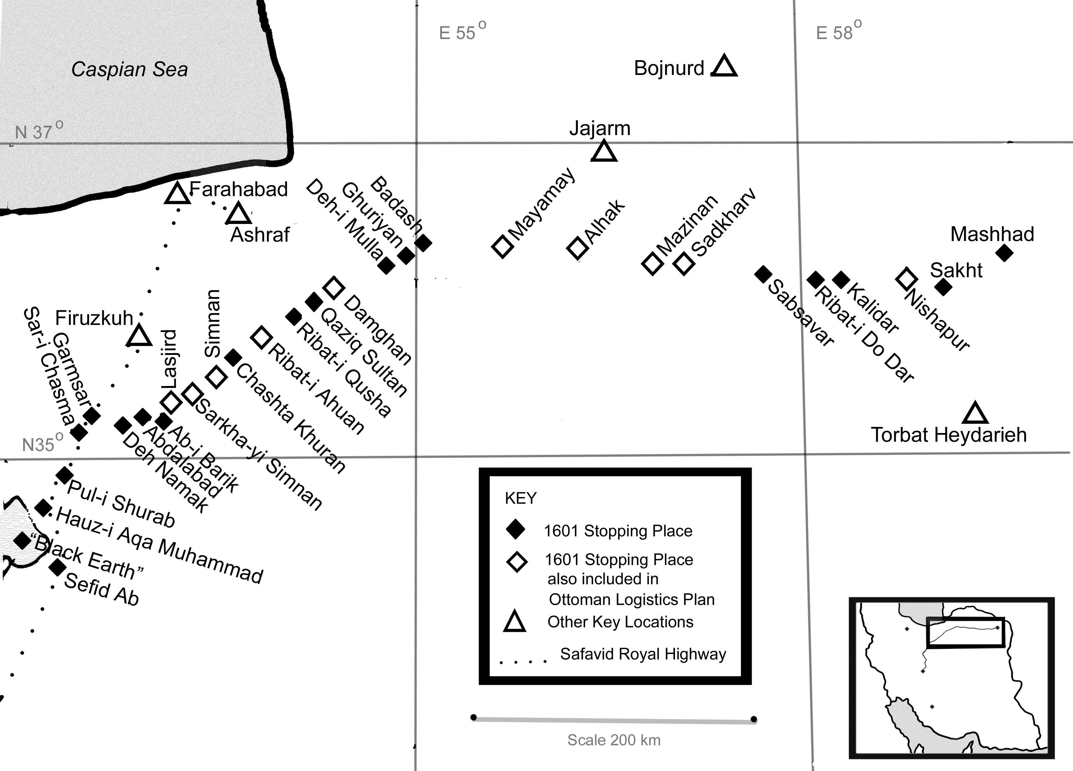
This schematic drawing shows the 24 known stopping places along the final part of Shah Abbas’ 1601 walk. Those indicated as open diamonds were included in an Ottoman logistics briefing for a bungled invasion of Iran during the reign of Shah Abbas.
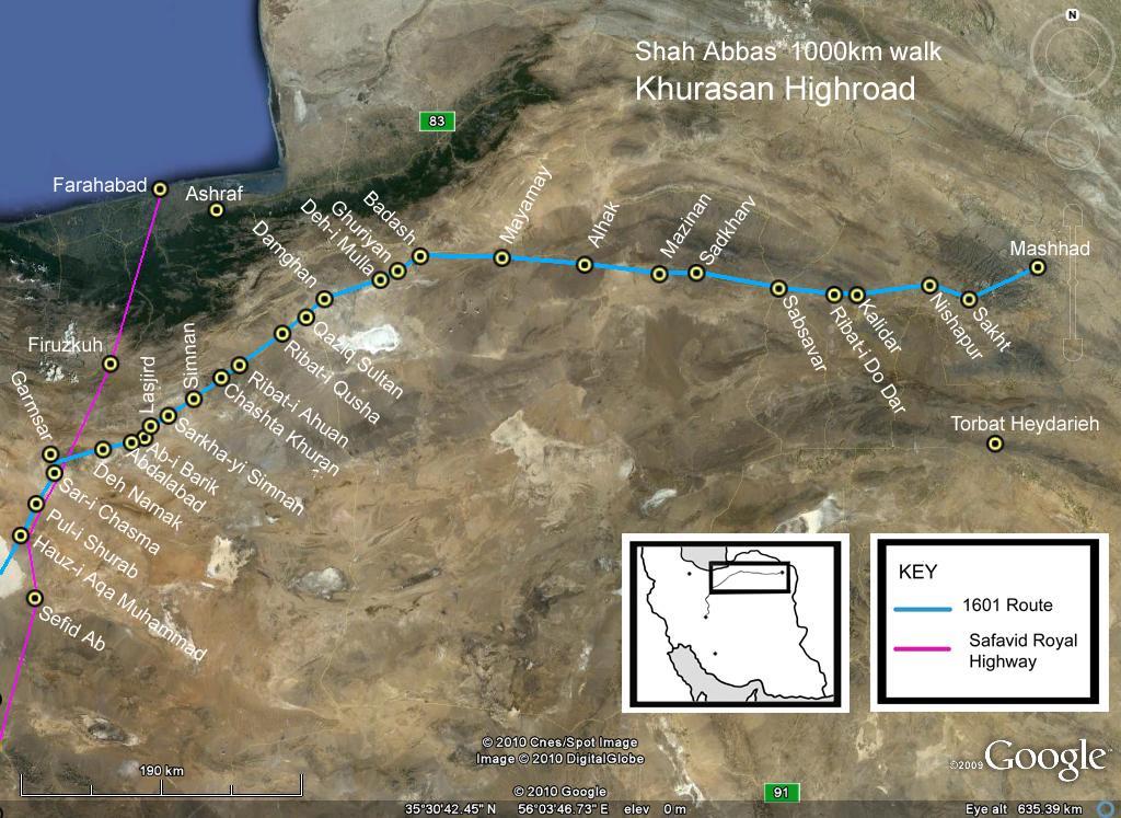
This satellite image shows the last section of Shah Abbas’ walk, with the 24 known halts along the Khurasan Highroad to the Holy City of Mashhad.
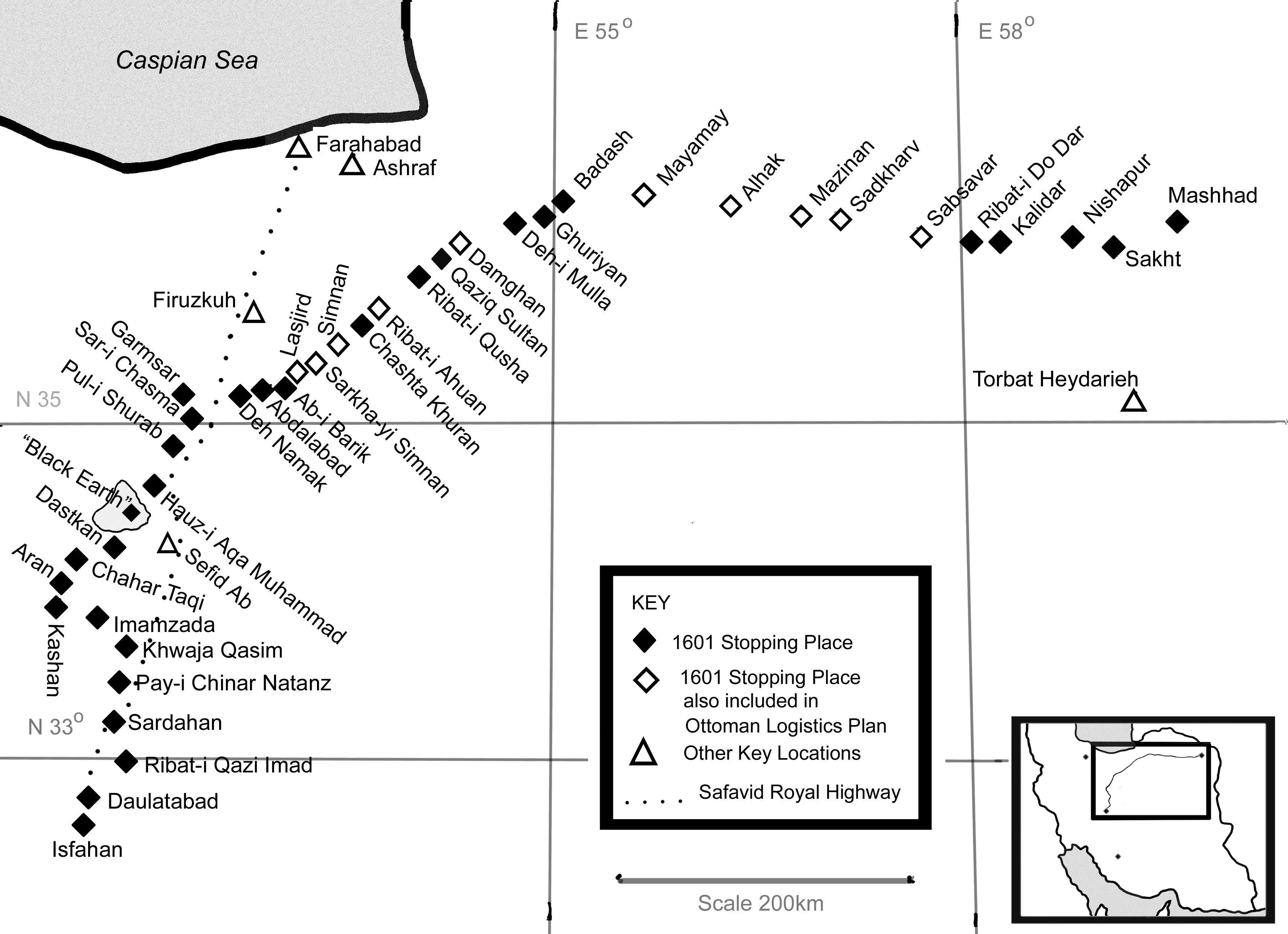
This schematic drawing shows the 40 known stopping places along the 1601 walk of Shah Abbas from Isfahan.

After Shah Abbas the First had walked through Kashan and across the kavir area of salt plain and salt mud, he turned eastwards along the Khurasan highroad towards the Holy City of Mashhad. This latter part of the Shah’s route is easy to trace exactly: many pilgrims came – and still come – this way. …
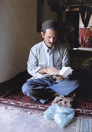
This is the evening before kuch (the migration) started so Morteza is in his garmsir (winter pasture) house, reading his Quran. All the Bakhtiari are Muslims, but Morteza was the only one who I ever saw praying.
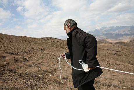
After we perfected rope-measuring on the flat, we also tried it out up and around hills. Along the Khurasan highroad, between two extant buildings where the Shah is known to have stopped on his 1601 walk, I have also compared the tanab with several other measurement systems.
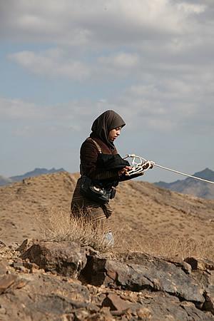
The back-marker in the rope-measuring team has to make sure the rope doesn’t get tangled.
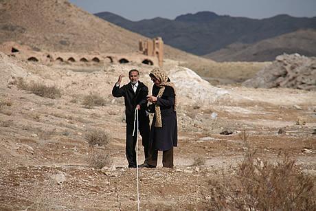
A lecturer in (modern) building metrics at the Islamic Azad University in Isfahan (standing to right) helped me get a rope-measuring team together. Near the Sardahan Caravanserai we soon found a simple and fast way of working. One person leads off at the front then, when the rope is fully extended, signals to the back-marker …