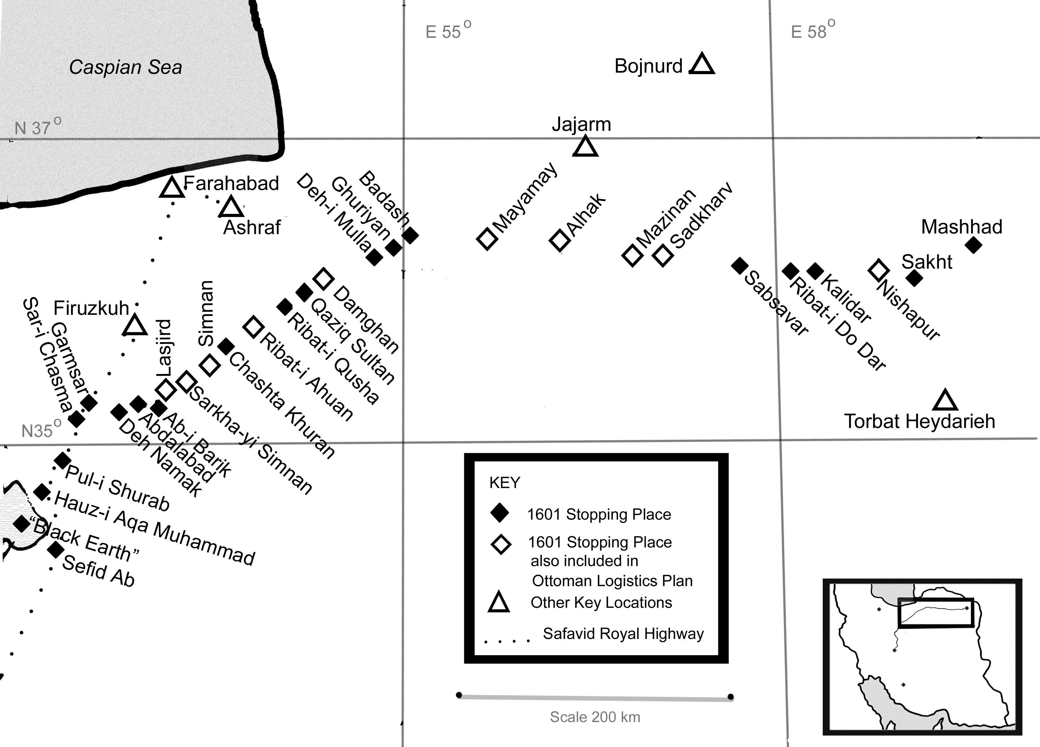
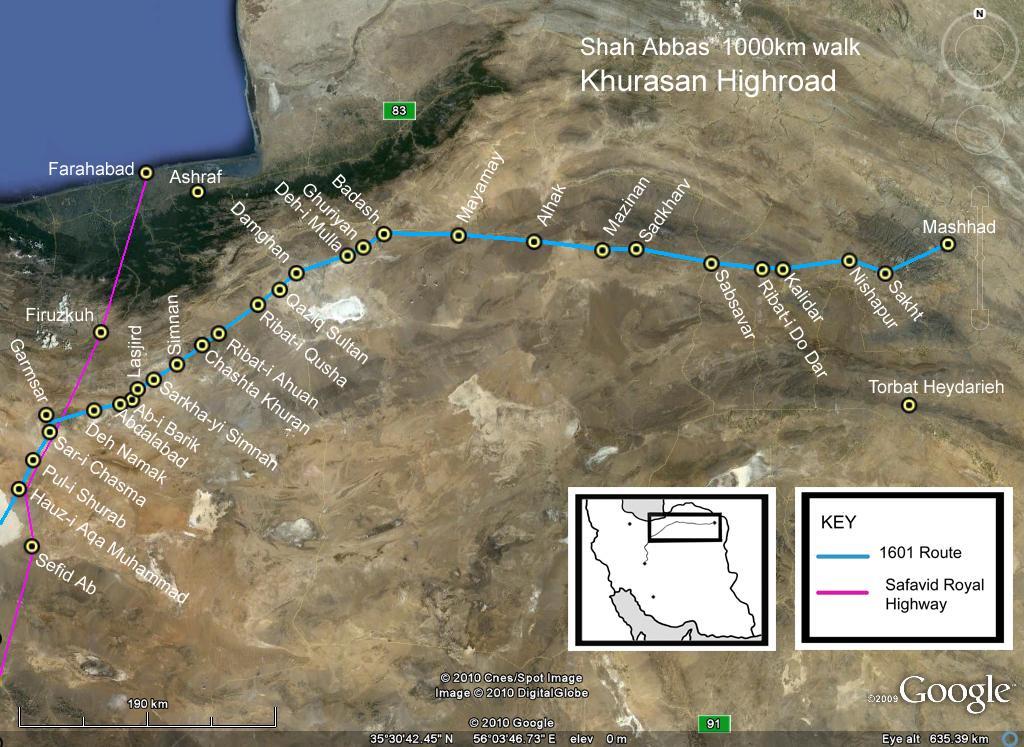
The Iranian Silk Road

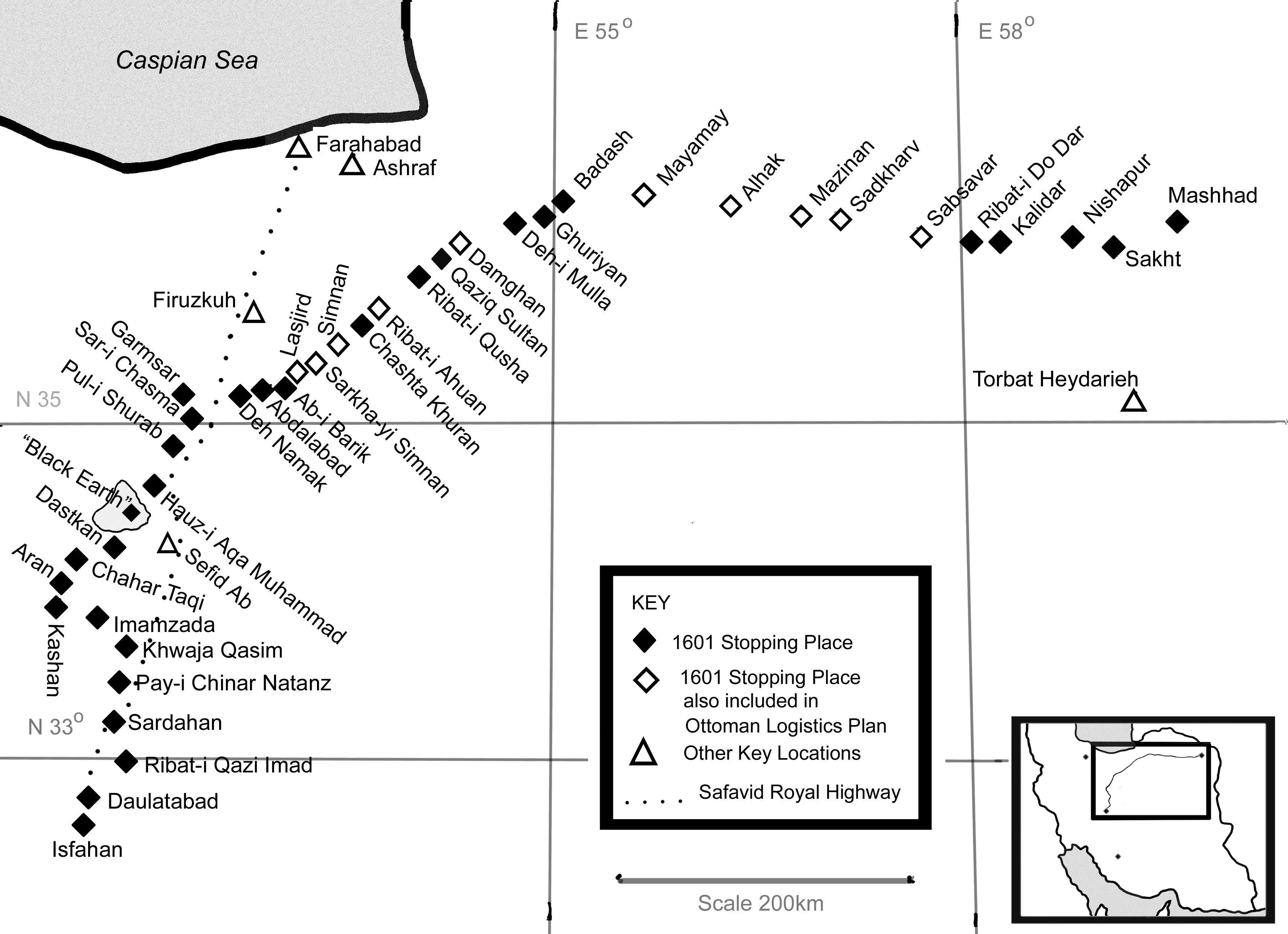
Deh Namak (literally, ‘Village of Salt’) was 441km from Isfahan along Shah Abbas’ walk. This satellite image shows the qaleh (fort) and the two caravanserais in this tiny village. I think Shah Abbas probably, in 1601, either camped here or – perhaps – lodged in the fort.